7Weather – We’ll trade the heat and sunshine for some showers, cooler temperatures and the wind this weekend. Boo! It won’t be a washout of a weekend, but showers will rotate in off and on. Temperatures will be stuck in the 50s. This weather pattern isn’t quick to move out of here…
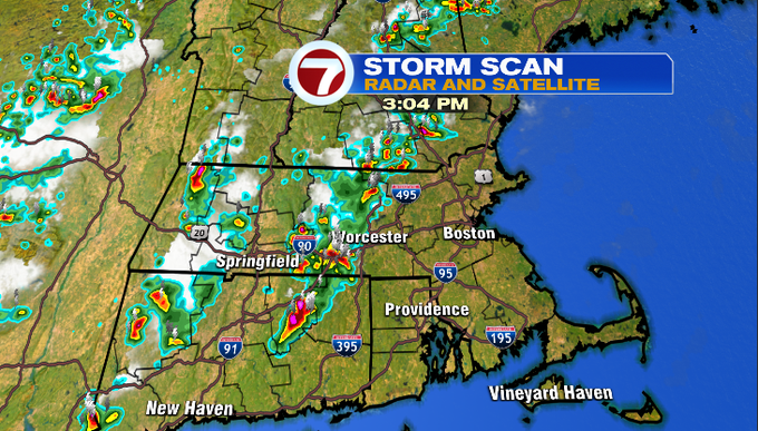
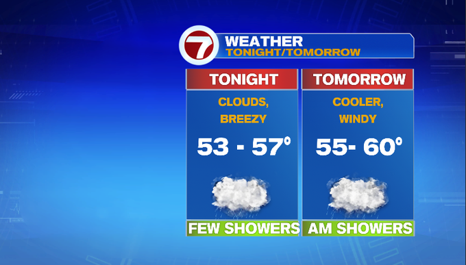
Scattered showers and storms sparked this afternoon. The activity started west of I-495 as you see above. We’ve seen reports of pea-sized hail in Auburn to 1/2″ hail in North Chelmsford. The storms are and dumping rain in short period of time, promoting a Flash Flood Warning for north central Middlesex County. Once we lose the daytime heating, we’ll lose the energy to fire off these thunderstorms. Scattered showers are still around tonight as a cold front drops down from Northern New England. Temperatures will drop quite a bit overnight into the low 50s.
Toss the shorts aside and grab a jacket for the weekend. Here’s a preview…
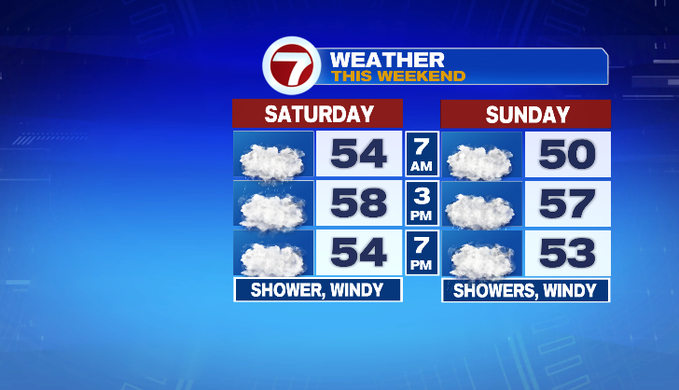
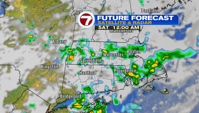
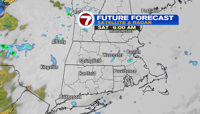
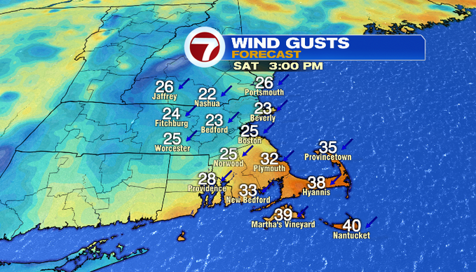
Tomorrow, the best chance for showers will be in the morning. There’s chance for spot shower along the coast through the day. We’ll mainly see clouds and feel the wind! The wind will be out of the northeast gusting 20-35 mph. Stronger gusts will be across southeast Mass. Temperatures will be stuck in the 50s!
There will be a High Surf Advisory tomorrow from 5 am to 8 pm for large breaking waves 5-8 feet. It’s not beach weather, but it will be dangerous to view the rough surf from jetties.
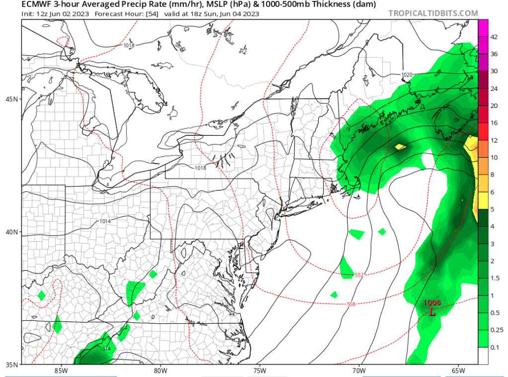
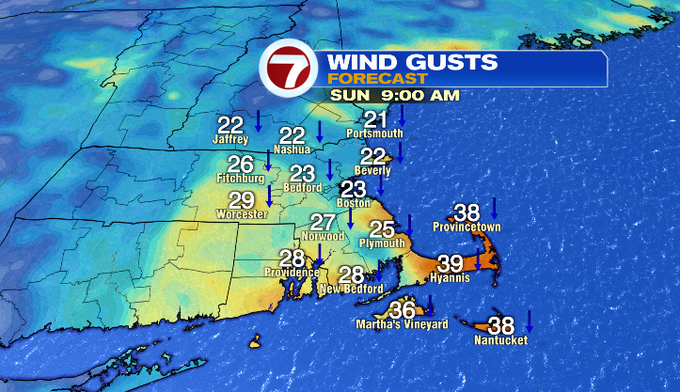
By Sunday, an area of low pressure will be to our southeast and continue to rotate in some showers on the backside of it. The best chance for showers will be along the coast. It’ll still be windy out of the north/northeast. Morning temperatures will be a touch cooler in the upper 40s/near 50°. High temperatures won’t recover that well and stay in the 50s.
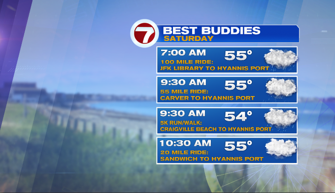
The Best Buddies Challenge is a “rain or shine” event, and we hope you can join us tomorrow!
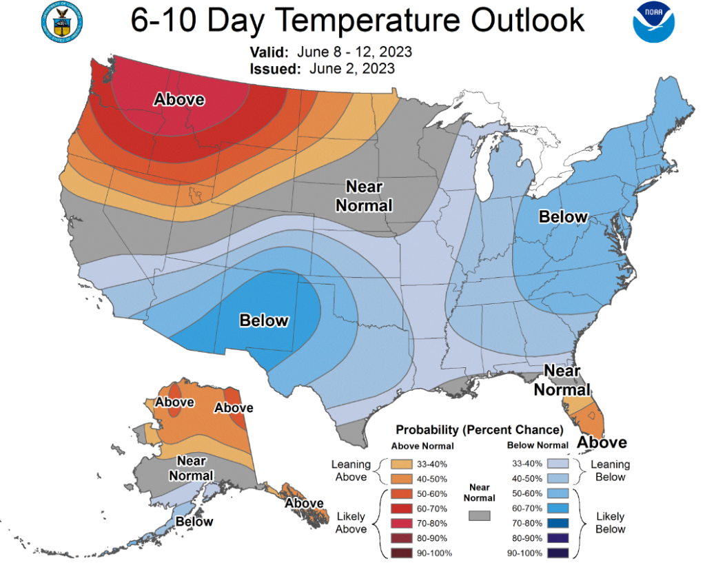
The cool pattern looks to linger past this weekend. That blue shading means there’s a good chance of below average temperatures over the next 6-10 days. There’s also a daily chance for a few showers through most of the 7-day forecast.
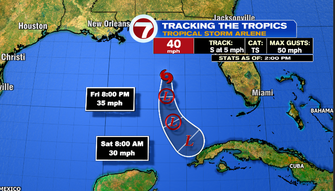
In the tropics, the first named storm of the 2023 Atlantic hurricane season became Tropical Storm Arlene in the Gulf today. There is no significant threat to land as it continues to decay into tomorrow.
-Meteorologist Melanie Black