A weak front is moving through South Florida this Thursday, which was responsible for the heavy thunderstorms much of the metro received Wednesday evening. As this front slowly pushes through the area, it will introduce milder temperatures and lower humidity — but it won’t last long.
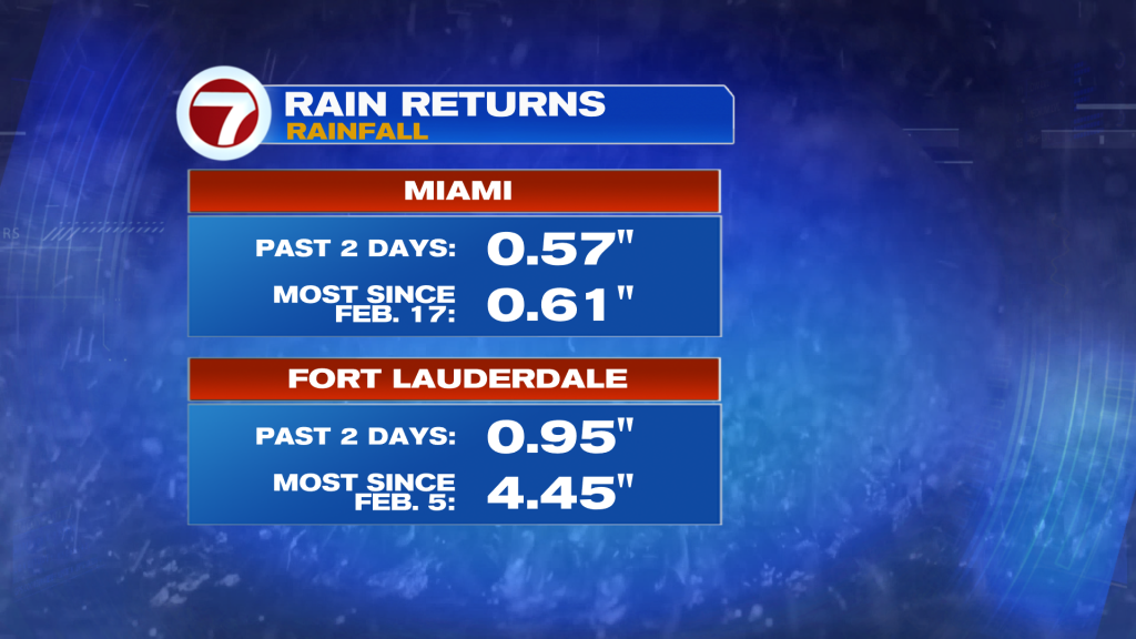
In Miami, the 0.57 inches of rainfall over the past two days (Tuesday and Wednesday) was the most since February 17 when 0.61 inches of rain fell. In Fort Lauderdale, just shy of 1 inch was recorded, which is the most in nearly two months!
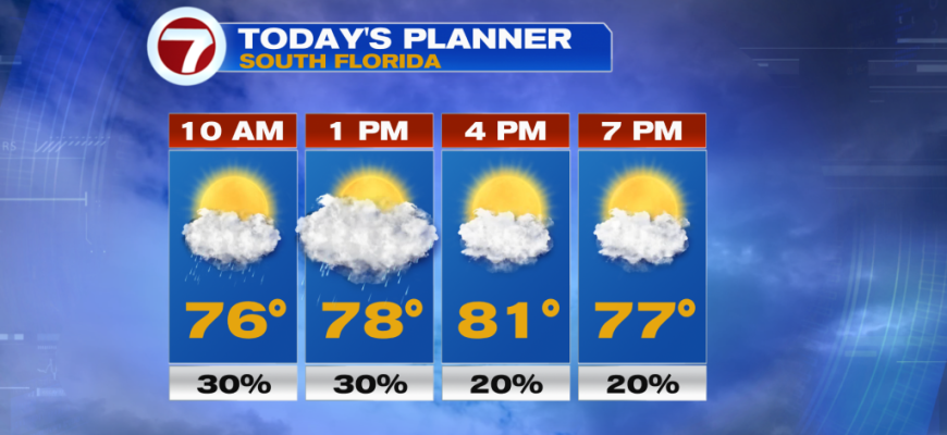
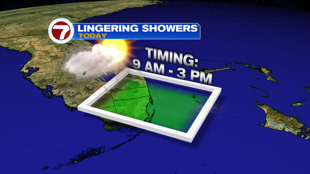
A few showers will remain possible this Thursday due to the weak front and moisture blowing onshore associated with a northeast wind. The best chance for any showers will be from 9 AM through 3 PM across Miami-Dade and Broward Counties. Then that rain risk will shift toward the Florida Keys with the best chance for any shower activity being in the mid-afternoon to evening hours.
Otherwise, expect times of sunshine paired with seasonable highs in the low to mid 80s today across South Florida. It will also begin to turn breezy this evening and becoming gusty at times tonight into tomorrow. Winds could gust up to 30 mph near the coast during this time period.
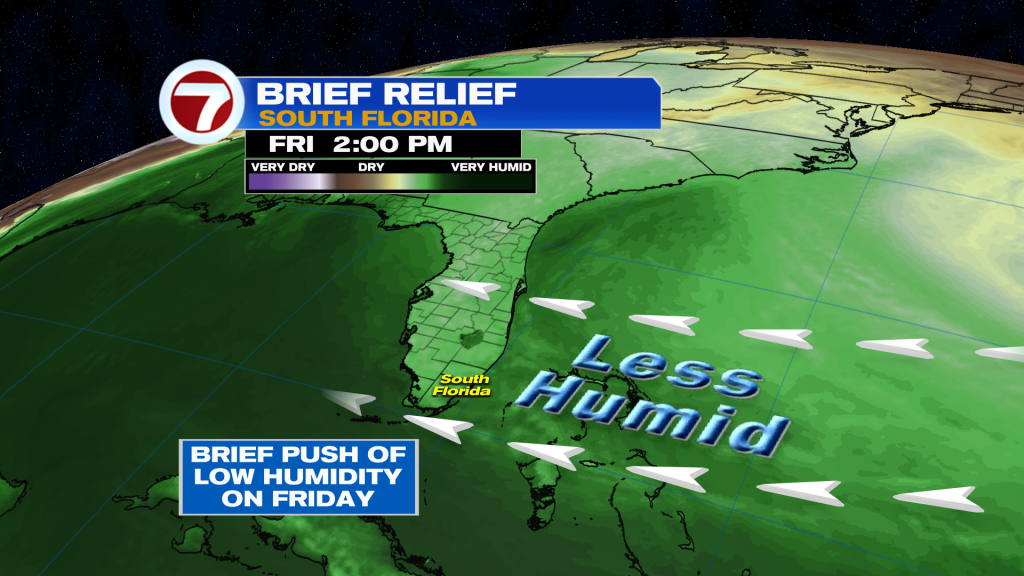
Friday is looking like a beautiful day, featuring mostly sunny skies, lower humidity and comfortable temperatures that will be just a touch warmer compared to today. The only negative will be the winds, which will make for a high rip current risk at the beaches and hazardous marine conditions.
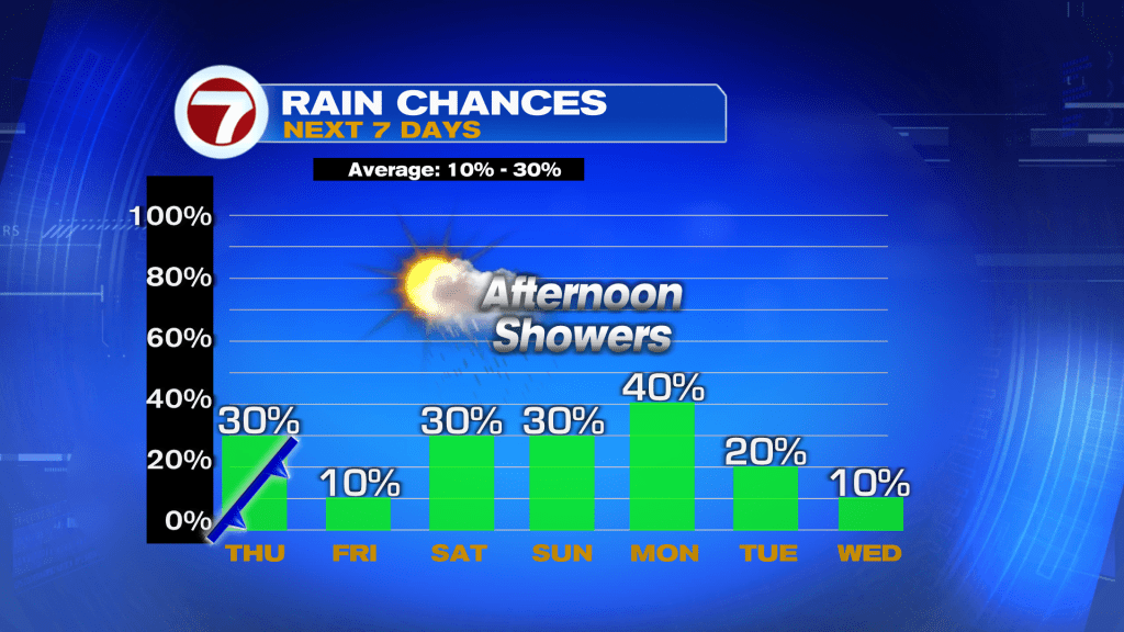
Winds will continue to veer from the east on Friday to the south-southeast this weekend. This means the warming trend will continue with highs now reaching the mid to upper 80s over the weekend. More moisture will also be drawn up from this more southerly wind, so rain chances will increase to a 30% chance for both Saturday and Sunday. Therefore, a few showers will be possible this weekend, especially in the afternoon and evening hours and across inland locations.
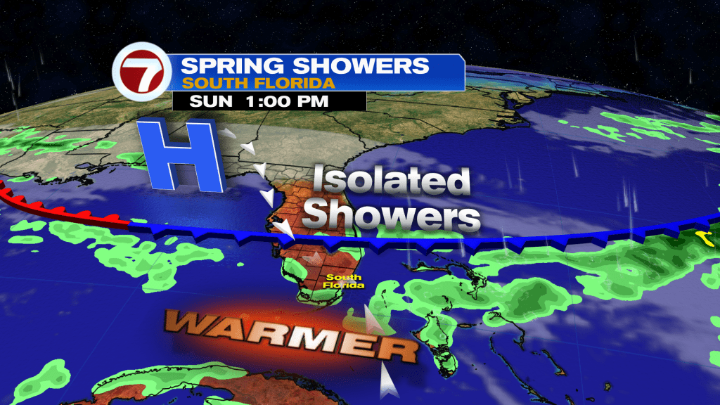
It’s not until Monday when our highest rain chance arrives over the next 7 days due to a nearby front which will likely weaken and stall just to our north. Temperatures into next week will remain warm and above average, hovering in the mid 80s.